Fire emission inventories for the contiguous United States were developed for 2008 and 2011, integrating satellite-based, ground-reported, burn scar, and burn severity data sets. Hourly speciated emissions, plume rise, and burn intensity were developed as inputs to the CAMx photochemical grid model, using state-of-science emission factors, consumption models, and fire weather inputs.
Our custom-built, open-source geospatial database is essentially a GIS with no user interface that allows Air Sciences to store massive amounts of georeferenced data—fire locations, gridded model results, meteorological data, air quality monitoring data, and other supporting data sets (such as county boundaries and non-attainment areas)—and perform efficient analysis and information retrieval.
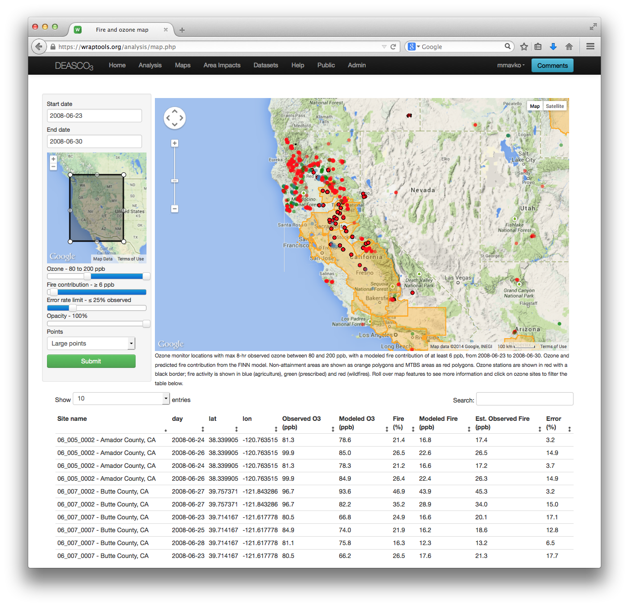
Our database was coupled with a modern, web-based user interface to support custom analyses using the same fire emission inventories, CAMx modeling, and monitored air quality data used to create the case study deliverables. Our “worksheet” approach to the user experience allows for customizable, on-the-fly creation of maps, plots, and summary tables from a modular toolbar, with all results instantly saved to a user’s profile for later retrieval.
Project Overview
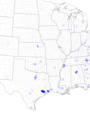
The Deterministic & Empirical Assessment of Smoke’s Contribution to Ozone (DEASCO3) project, funded by the Joint Fire Sciences Program (JFSP), produced analytical results and a dynamic, web-based technical tool (deasco3.wraptools.org) that enables Federal Land Managers (FLMs) and other users to participate more fully in ozone air quality planning efforts. For Western Regional Air Partnership, Air Sciences teamed with ENVIRON and multiple federal collaborators from the U.S. Park Service and Forest Service to complete this work. A suite of 19 case studies was developed to characterize the relationship of emissions from fire to ozone concentrations across a broad range of circumstances (e.g., geographic locations, fuel conditions, time of year, fire types, and contributions to elevated background levels and levels in excess of the current and proposed ozone standards). These complex technical analyses were made accessible using instructive tables, charts, and maps that describe how and to what extent fires contribute to ambient ozone concentrations. The suite of case studies characterizes situations analogous to those that FLMs may face with current conditions and in the future. The online tools allow FLMs to survey, review, and grab the technical results and findings of the most applicable case studies, and/or generate new case studies, to effectively contribute to the state and EPA processes of State Implementation Plan development, declaration of Exceptional Events, designation of non-attainment areas, establishment of background levels of ozone, and more.
A sister study, PMDETAIL, will apply these same tools and concepts to assessing particulate matter across the United States.
VISIT THE WRAPTOOLS WEBSITE
Check out our continued progress and browse project deliverables at wraptools.org.
These efforts were part of the JFSP Smoke Science Plan, a coordinated series of research questions on smoke management and air quality funded by the Department of the Interior.